On Saturday, February 21, 2026, Dr. Eng. Farhan Al-Fartousi, Director General of the General Company for Ports of Iraq, announced that Iraq has officially submitted its maritime domain map and related coordinates to the United Nations. This measure aims to safeguard Iraq’s maritime rights and strengthen the country’s negotiating position in matters concerning maritime boundaries.
The Director General stated: “On February 18, the Permanent Mission of the Republic of Iraq to the United Nations formally deposited the map and coordinates, which were subsequently circulated to all member states. This achievement followed extensive technical work carried out over a long period, involving specialized Iraqi committees and joint meetings with several government entities.”
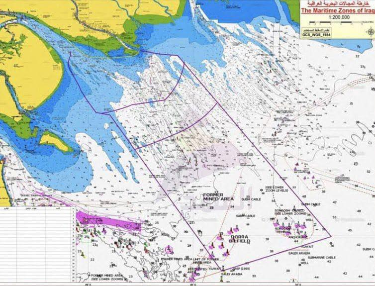
He added: “The Ports of Iraq maintained permanent technical representation within these committees and contributed its expertise to the preparation of the maritime documents. The map encompasses Iraq’s entire maritime domains, including internal waters, territorial waters, contiguous zones, and the exclusive economic zone.”
Dr. Al-Fartousi emphasized that this step will enhance the protection of Iraq’s maritime rights and reinforce the country’s position in any international discussions or procedures related to maritime boundary delimitation—particularly regarding the Khor Abdullah file beyond marker (162)—thus providing Iraq with stronger technical and legal support at the international level.